
Map & Directions
Get custom driving directions from Google here ».
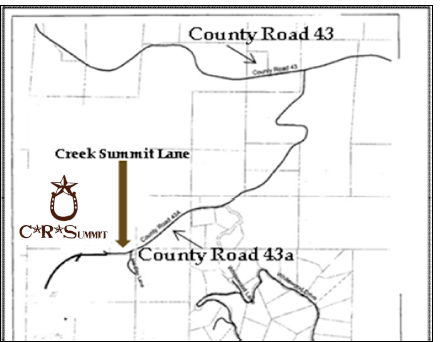
33255 Creek Summit Lane, Steamboat Springs, CO 80487 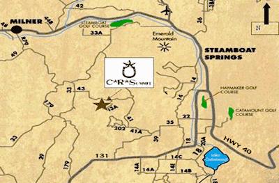
Directions To Main Ranch from West end of Town:
From US Hwy 40 (Lincoln Avenue), head West on 13th Street until it joins with RCR 33. Travel West/Southwest about 10 miles to RCR 43. Turn Left onto RCR 43 at High Tension Power Line Towers and travel East/Southeast about 3 miles to the “top of the hill”, then turn Right onto RCR 43a. Take RCR 43a about 1.5 miles to its “end” at Mac Day Lane, veer to your Left on Mac Day Lane heading south for about 20’ then turn right (West) on to Creek Summit Lane. Park your vehicle and trailer outside brown gates and walk through gates to riding center.
Directions To Main Ranch from East end of Town/MT. Werner:
Take Mt. Werner West; go under US 40 to first stop sign. Turn Left/South on to RCR 14. Travel South on RCR 14, “veering to the right” as it briefly becomes RCR 35 and then RCR 41. Continue for a several miles until you reach “the little red school house,” and then turn right onto RCR 41. Follow RCR 41 North/Northwest as it becomes RCR 43 after the “elbow turn”. At the “top of the hill” turn left onto RCR 43a. Take RCR 43a about 1.5 miles to its “end” at Mac Day Lane, veer left on Mac Day Lane heading south for about 20’ then turn right (West) on to Creek Summit Lane. Travel about 1/2 mile west to Arena at CR Summit Riding Club. Parking and Drop-Off signs are posted.